


UNH Receives $35M from NOAA for Ongoing Ocean Mapping Work

Jerry Jacobs, professor of sociology at the University of Pennsylvania, will present the Holden Lecture at UNH.
DURHAM, N.H. - The University of New Hampshire's Center for Coastal and Ocean Mapping (CCOM) has received $35.7 million from the National Oceanic and Atmospheric Administration (NOAA) to continue the Joint Hydrographic Center, a NOAA partnership and a national ocean-mapping research center. The funding, granted through a competitive process, provides the center with $7,151,000 per year for five years, through 2015.
"This continuation of funding will support the ongoing research, training and creation of state-of-the-art ocean mapping technologies that have made the Joint Hydrographic Center a national center of excellence in ocean mapping," says Larry Mayer, founding director of CCOM and co-director of the JHC. "Since the center's creation in 1999, we've made enormous advances in our understanding of the seafloor and marine environments. We look forward to bringing our tools and expertise to bear on a range of new environmental and policy issues involving safe navigation and much, much more.
"In the first 10 years of its operation, the Joint Hydrographic Center has provided NOAA and the entire hydrographic survey community with significant improvements in ocean mapping technology. We are pleased that the partnership between UNH and NOAA's Office of Coast Survey will be continuing through this cooperative agreement," says Captain John Lowell, who as director of NOAA's Office of Coast Survey and the U.S. National Hydrographer is responsible for the nation's hydrographic and nautical charting programs.
The Joint Hydrographic Center's research focuses on the use of sophisticated sensors to increase the accuracy and resolution of coastal and ocean mapping, greatly expanding the applications of data that's been used in chart creation. The center also has developed innovative tools, several of which have become industry and research standards, for the visualization of the data it collects.
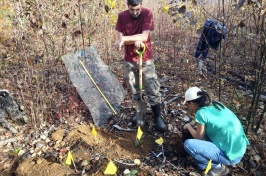
Among its many projects are the collection of multibeam bathymetry and acoustic backscatter data that can be used to support an extended continental shelf under Article 76 of the United Nations Convention of the Law of the Sea. JHC scientists have collected data in U.S. Arctic and Gulf of Alaska, Atlantic, Bering Sea, Gulf of Mexico, and Northern Marianas. Moving forward, the JHC is exploring mid-water mapping using a new generation of sonar that can record features such as gas bubbles, obstructions to navigation, or fish in the water column.
The center also has developed an ocean-mapping-specific curriculum and offers master's and doctorate degrees, as well as a one-year post-graduate certificate, with a specialization in ocean mapping. "If we are to use modern seafloor mapping data to its fullest extent, we must also ensure that we have a cadre of new-generation hydrographers who understand and fully appreciate both the complexities and the potential of these comprehensive ocean mapping approaches," says Mayer.
The University of New Hampshire, founded in 1866, is a world-class public research university with the feel of a New England liberal arts college. A land, sea, and space-grant university, UNH is the state's flagship public institution, enrolling 12,200 undergraduate and 2,200 graduate students.
-30-
Reporters and editors: Larry Mayer, director of UNH's Center for Coastal and Ocean Mapping, is available at 603-862-2615 or mailto:larry@ccom.unh.edu"
Latest News
-
July 2, 2024
-
June 18, 2024
-
June 18, 2024
-
May 17, 2024
-
May 14, 2024