


UNH Grad Certificate Course in Geospatial Science Begins Aug. 13
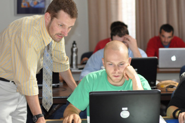
Michael Routhier (left) is the certificate program coordinator and instructor for the Applied GIS for Research class, which begins Monday, August 13. Photo by Katelyn Dolan, UNH-EOS.
DURHAM, N.H. - The first course in a new Geospatial Science Graduate Certificate program is being offered beginning Monday, Aug. 13, 2012, on the University of New Hampshire's Durham campus. The two-week, four-credit Applied GIS for Research class is open to anyone holding an undergraduate level degree.
The course, GSS 805, will be held from 9 a.m. to 4 p.m. Monday through Friday August 13-24. It is the inaugural offering of the graduate certificate program that consolidates a wealth of geospatial classes across the UNH campus.
The new, multidisciplinary program is designed to help prepare students for work within the rapidly expanding field of geospatial science, which is the study and use of spatially referenced datasets to derive information and produce useful knowledge.
Currently, the geospatial market is growing at an annual rate of 35 percent with the commercial subsection expanding by 100 percent every year. This increased use of spatial thinking has created a demand for educated students and professionals with relevant skills in methods and technologies that develop, analyze, and visualize geospatial data.
Says Michael Routhier, the certificate program coordinator and instructor for GSS 805, "This new program will allow students to learn about the geospatial science industry and get hands-on experience with the tools most commonly used within the field."
According to Routhier, the first week of the intensive-learning class will be geared towards understanding geospatial concepts, learning the applications of the technology, and writing a GIS project proposal. Week two will be spent carrying out the proposed work for the GIS project.
"If students come in with their own research already in hand we can help them move that forward and, if not, we can help them develop a project for the second week."
As a discipline, geospatial science focuses on using information technology to understand people, places, and processes of the world around us. Using geospatially referenced data, it is now common for scientists to study and model scientific phenomena; for engineers and geographers to analyze human populations, infrastructure, and hazards; for businesses to target markets in the most optimal way; and for people to navigate through unknown cities.
For further information about the Geospatial Science Graduate Certificate program and the upcoming Applied GIS for Research course, visit http://geospatial-science.unh.edu/Grad-Certificate You may also contact program coordinator Michael Routhier directly at (603) 862-1954 or mike.routhier@unh.edu
The University of New Hampshire, founded in 1866, is a world-class public research university with the feel of a New England liberal arts college. A land, sea, and space-grant university, UNH is the state's flagship public institution, enrolling 12,200 undergraduate and 2,300 graduate students.
Photograph to download: http://www.eos.unh.edu/newsimage/gis_lg.jpg
Caption: Michael Routhier (left) is the certificate program coordinator and instructor for the Applied GIS for Research class, which begins Monday, August 13. Photo by Katelyn Dolan, UNH-EOS.
-30-
Latest News
-
December 4, 2025
-
November 26, 2025
-
November 6, 2025
-
November 5, 2025
-
October 24, 2025