


NH GRANIT's many data offerings of the state's natural resources and infrastructure are accessed by thousands of users each week.
By some estimates, almost 90 percent of the data we are exposed to on a daily basis has some sort of geographic component to it — just think about the COVID-19 hotspot maps of the U.S., for example. Maps and other forms of data visualization products help scientists to track trends and convey information that can lead to better decision-making. For more than three decades, a small team of UNH scientists has provided vital map-based information about New Hampshire’s natural resources and infrastructure, all the while adapting to new technologies, helping communities, and offering jobs that have shaped the career paths of students and young professionals alike.
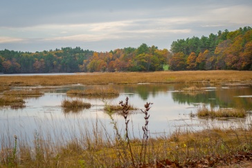
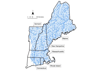
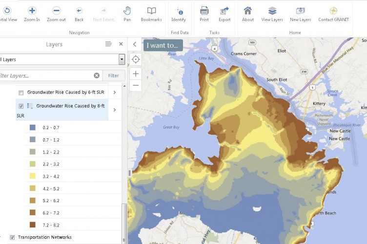
The team, called N.H. Geographically Referenced Analysis and Information Transfer System (NH GRANIT), is based at UNH’s Durham campus and serves as a clearinghouse for the state’s geographic information systems (GIS) data — a computer program where layers of data and maps can be integrated with one another. With data holdings ranging from the impacts of coastal flooding and sea level rise on properties at various elevations, to how forestry practices can alter wildlife habitat, NH GRANIT remains an important source of relevant and timely geographic information used by a broad cross-section of society.
“The NH GRANIT team interacts with people from a lot of different disciplines, so it’s always challenging and exciting,” says Fay Rubin, the founder and longtime director of NH GRANIT up until her retirement in late 2019. “It’s nice to feel like we’re making a difference in the state.”
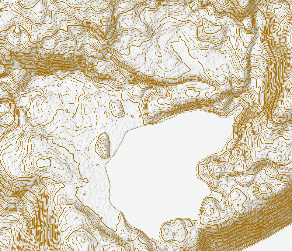
Among their recent accomplishments, the NH GRANIT team completed a statewide map indicating the topography in two-foot contour lines — a more detailed upgrade from the previous 10’-contour line maps that can help engineers and land managers with improved plans for construction, surveying and timber sales as well as for trail mapping. NH GRANIT also helped to map out broadband access throughout the state, the data from which was incorporated into the Federal Communications Commission’s National Broadband Map to help businesses and policymakers find out which carriers offer high-speed internet in various locations.
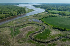
And in a state known for its historic rock walls lining hay fields and farmhouse properties, NH GRANIT and the NH Department of Environmental Services developed the NH Stone Wall Mapper, which has utilized crowdsourcing techniques to map more than 13,000 miles of charming rock borders thus far.
The primary data viewing tool, GRANITView, is accessed by more than 1,300 users per week; the organization’s web services — like conservation and public land records, tax parcels, orthophotography (aerial maps or satellite imagery) and light detection and ranging (LiDAR) maps, a remote sensing method that uses lasers to examine the surface of the Earth, measure distances, and create high-resolution 3D maps — are accessed thousands of times each day. NH GRANIT’s continued success and relevance, as reflected in these numbers, is a testament to Rubin’s hard work and passion for the subject matter, as well as her commitment to collaboration for the greater good.
Adapting to Change
NH GRANIT began as an early adopter of GIS technology in the mid-1980s, when it found its footing in a dispute over whether or not a site in western New Hampshire could serve as a place for high-level radioactive waste disposal.
“We were able to demonstrate that the selection of the site in New Hampshire was inappropriate based on some newly updated soil quality data,” Rubin explains. “That was an early but important success for us, it demonstrated how the GIS technology could really be used.”
"In a state like New Hampshire, which does not have a great deal of county and town GIS infrastructure, data development projects involving NH GRANIT may not have gotten done in their absence."
From there, the NH GRANIT team began digitizing the state’s soil and wetland maps and offering GIS services for organizations that couldn’t afford the computer software at that time. NH GRANIT has served numerous organizations over the years, including state agencies, municipalities, regional planning agencies, and nonprofit organizations like land trusts and watershed associations, providing them with the data they need to provide services for their stakeholders and communities.
Shane Bradt ‘00G ‘12G, the geospatial technology specialist for UNH Cooperative Extension, collaborates with NH GRANIT on numerous GIS-related projects and workshops. He reflects back on what has made the organization unique and valuable throughout the years.
“In addition to distributing data, NH GRANIT has played a key role in developing GIS data layers, both on its own and in partnership with numerous other agencies,” he explains. “In a state like New Hampshire, which does not have a great deal of county and town GIS infrastructure, data development projects involving NH GRANIT may not have gotten done in their absence.”
The NH GRANIT team has adapted to myriad changes over the past few decades, most notably by making the leap from using hardcopy paper maps to storing and accessing the data entirely online. The tiny team of five has seen a lot of recent staffing changes as well — longtime NH GRANIT GIS analyst David Justice ’84 ‘89G stepped up as the organization’s new acting director after Rubin retired, and a few scientists from UNH’s Earth Systems Research Center have shuffled their work responsibilities to assist with NH GRANIT’s forthcoming upgrades to improve data access speeds.
NH GRANIT receives almost all of its program funding from grants outside the university, and some of that money was delayed due to the COVID-19 pandemic. Nevertheless, the team’s small size makes it nimble and capable of adapting to change, and Justice remains focused on finding solutions to ensure they can continue moving forward with their upgrades as soon as possible.
Shaping Career Paths
Over the course of its existence, NH GRANIT has employed more than 40 UNH students, many of whom have remained in that line of work for the duration of their careers. Justice himself was employed at the organization while attending UNH for graduate school, and current NH GRANIT database manager Chris Phaneuf ‘00 worked there as an undergraduate as well.
"It was a miracle to me that we had NH GRANIT at UNH and I was there and able to jump in and learn."
Dave Wickliffe ’91 is currently a geospatial engineer at Esri — the makers of ArcGIS software — in Washington, D.C., where he supports software development and project work for aeronautical charting and GIS for airports. Wickliffe was a geography major at UNH when he spotted a bulletin board flyer advertising work-study positions at NH GRANIT. He applied and was accepted, and so during his junior and senior year at UNH, Wickliffe helped to digitize New Hampshire soil maps and national wetland inventory maps and learned how to use GIS in the process.
He went on to work as a GIS specialist for both the Strafford and Rockingham Regional Planning Commissions, with a stint at an engineering company in New York in between; he’s been working at ESRI for almost a decade now. Wickliffe believes that work-study experience at NH GRANIT changed the trajectory of his career. “It was my first introduction to GIS and all my jobs since then have been related to it,” he explains. “It was a miracle to me that we had NH GRANIT at UNH and I was there and able to jump in and learn.”
Bradt, the geospatial technology specialist for UNH Cooperative Extension, refined his expertise in GIS by working at NH GRANIT between his master’s and doctorate degrees at UNH. Like Wickliffe, Bradt credits the organization with helping to shape his career path.
“Through my year working at NH GRANIT, I became much more proficient with GIS, both from the software perspective and in an appreciation of all the details needed to create and analyze GIS data,” Bradt says. “It was due to my work there that I was able to start teaching GIS workshops with Cooperative Extension, which put me on the path to my current job. Without working at NH GRANIT, I would definitely not be where I am today.”
The benefits go both ways, according to Justice, who credits the zeal of the student and early career workers for helping NH GRANIT thrive in the past — and hopefully well into the future.
"Over the past 35 years, NH GRANIT has evolved and adapted to meet the constantly changing field of GIS and deliver pertinent and critical data to its users,” Justice says. “With the near logarithmic pace of change in GIS nowadays, NH GRANIT will rely on the enthusiasm, resourcefulness, dedication, and access to eager student workers as they adapt to and harness this change and continue its contribution to New Hampshire's GIS landscape."
The Institute for the Study of Earth, Oceans, and Space (EOS) is UNH’s largest research enterprise, comprising sixcenters with a focus on interdisciplinary, high-impact research on Earth and climate systems, space science, the marine environment, seafloor mapping, and environmental acoustics. With more than $58 million in external funding secured annually, EOS fosters an intellectual and scientific environment that advances visionary scholarship and leadership in world-class research and graduate education.
-
Written By:
Rebecca Irelan | Institute for the Study of Earth, Oceans, and Space | rebecca.irelan@unh.edu | 603-862-0990