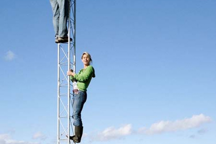
Lucie Lepine and Frankie Sullivan on the Moore Fields tower preparing for instrument installation. Photo by Andrew Ouimette, UNH-EOS.
Since 2003, the Bartlett Experimental Forest in the White Mountains has been New Hampshire’s only site for a state-of-the-art instrument that takes the pulse of the landscape continuously.
Now, as part of the National Science Foundation/NH Experimental Program to Stimulate Competitive Research (EPSCoR) program's Ecosystems and Society project, the capacity to gauge the land’s vital signs has quadrupled and broadened with the installation of four “eddy flux” towers in forest, field, farmland, and an urban/residential environment.
That diverse spread of the towers will help the NH EPSCoR scientists understand land use/land cover interactions with climate to better assess climate conditions in NH under future change scenarios—a central goal of the Ecosystems and Society project.
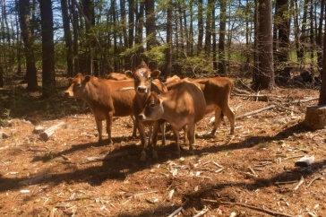
Three of the towers rise roughly 12-feet above ground and are located at Kingman Farm in Madbury (field), Moore Fields in Durham (agricultural), and the West Edge Parking Lot on campus (urban/paved). The fourth is the 120-foot tower over a mixed forest located at Thompson Farm in Durham, which predates the recent EPSCoR effort and provides the platform for the flux instruments.
“A simple way to look at this is that the towers allow us to very accurately measure how these different landscapes ‘breathe and sweat’ and reflect light and heat throughout the day and night as environmental conditions change,” says scientist Andy Ouimette of the Earth Systems Research Center within the UNH Institute for the Study of Earth, Oceans, and Space (EOS). Ouimette, along with ESRC research scientist Lucie Lepine, is heading up the flux tower work.
The “breathing” is the respiring of carbon dioxide (CO2), the reflection of light is what’s known as albedo, and the sweating is evapotranspiration—a combination of simple water evaporation and that transpired to the atmosphere from plants.
Says Ouimette, “The effect of land cover on both local and larger scale climate processes is a result of all three of these processes, not just emissions of CO2.”
For example, forested landscapes have traditionally been thought of as having a cooling effect on global climate due to their ability to take up and store CO2. However, compared to other land cover types, forests are dark and cause the Earth’s surface to absorb a much higher proportion of incoming solar radiation (low albedo) than other land cover types. Despite their low albedo, forests tend to have a cooling effect on local climate because they sweat a lot (high evapotranspiration rates).
“A parking lot may be the other extreme,” Ouimette says. “Urban surfaces tend to reflect a much higher proportion of incoming radiation but due to their inability to sweat or absorb CO2 have a warming effect on local and global climate.”
The towers, which are known formally as eddy covariance flux towers, are equipped with sensors that measure minute changes in the amounts of CO2 and water in turbulent air or “eddies” above the land surface. They also include a suite of meteorological sensors to measure incoming and reflected radiation, air and soil temperature and humidity, and precipitation, all of which provide information on energy fluxes between the biosphere and atmosphere.
“The towers can measure how fast the wind is moving in all directions—up, down, side-to-side, all around,” says Ouimette, “and at the same time are measuring the amount of carbon and water vapor in that wind. And it does this twenty times per second.”
When those measurements are compared and summed (the “covariance” part) over the course of a month or the year, the scientists know how much carbon has gone up or down. If more went up, the land is giving off carbon—a carbon source, and vice versa—a carbon sink.
Having four flux towers strategically located in different environments will provide researchers with data that can be used in the Ecosystems and Society project’s effort to create realistic future scenarios of what the Granite State could look like depending on land use decisions.
Originally published by:
Spheres Online, Institute for the Study of Earth, Oceans, and Space
-
Written By:
Staff writer | Communications and Public Affairs