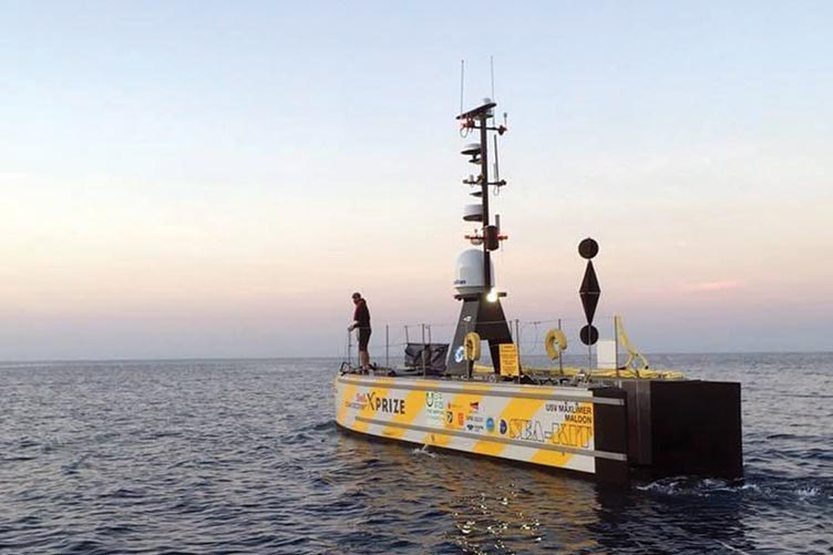
SEA-KIT, an unmanned surface vehicle designed by the UNH alumni team to map the seafloor
More than 80 percent of our Earth’s seafloor is not mapped to high resolution; we have a clearer picture of the surface of Mars than of the ocean floor. A team of UNH alumni has created an ocean mapping system that could quickly change that. And along the way, they’ve become a top finisher for the $7 million Shell Ocean Discovery XPRIZE, a global competition challenging teams to advance deep-sea technologies for ocean floor exploration.
The GEBCO-Nippon Foundation Alumni Team, 15 global ocean scientists and hydrographers who are alumni of the Nippon Foundation/GEBCO postgraduate certificate program at UNH’s Center for Coastal and Ocean Mapping, beat out nearly all of the original 32 teams competing for the Shell Ocean Discovery XPRIZE. Their successful concept features an unmanned surface vehicle paired with autonomous underwater vehicle technology to map the seafloor. Removing humans at sea — and the large, expensive research ships they require — brings efficiency to mapping the sea floor.
“We have always maintained that the development of new technology will be a game-changer for mapping the seafloor by 2030,” says Rochelle Wigley, director of the Nippon Foundation/GEBCO program at UNH and coordinator of the team’s XPRIZE effort.
-
Written By:
Beth Potier | UNH Marketing | beth.potier@unh.edu | 2-1566